Who we are
Ottosi is a small, committed team spanning Finland, Estonia and Turkey, registered with Ottosi Tech OÜ. We’ve spent years working with satellite imagery, geospatial data and machine learning. Our backgrounds cross public safety, utilities, forestry and research — united by a belief that technology should serve communities when it matters most.
Climate change is a human problem — which means it’s a human responsibility to solve. We choose to act, building practical systems that reduce risk, speed response and protect the places we love.

What we build
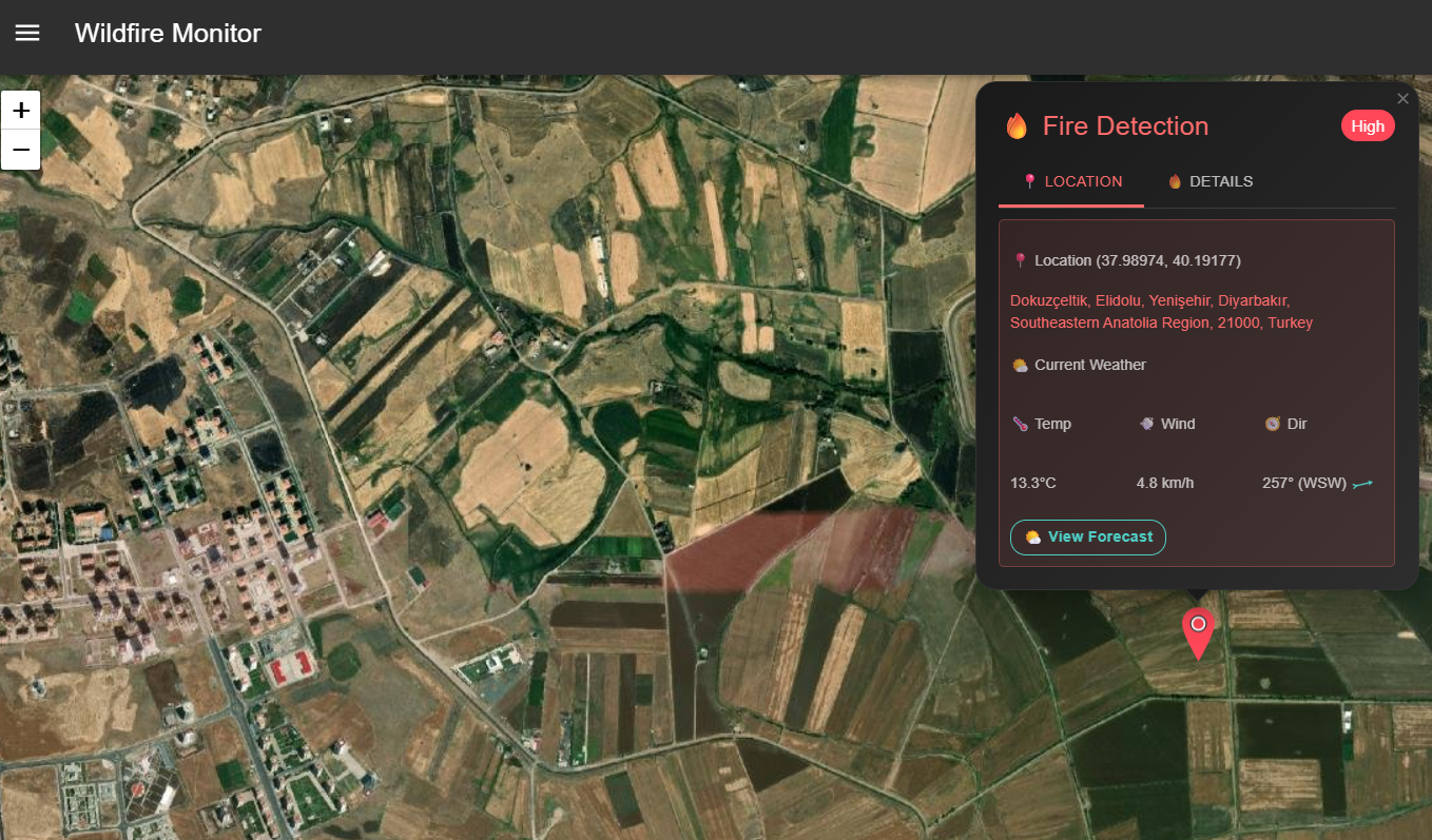
We turn raw Earth observation into clear decisions. Our platform fuses multi-sensor satellite data with predictive AI to detect risky points, map burned areas, and forecast fire spread. It’s fast, explainable and designed for the realities of the field.
Satellite + AI
Modern ML on top of proven remote-sensing science — tuned for accuracy, speed and clarity.
Operational by design
Outputs that brief crews, inform switching and support decisions under pressure.
Open & pragmatic
We integrate with what you already use, and explain how scores are produced.
Where we’re going
- Land sensors — low-power edge devices for micro-climate and fuel moisture signals.
- Drones & robots — autonomous scouts and responders integrated into the wildfire workflow.
- Faster alerting — tighter loops from detection to notification and response.
Everything we build is aimed at one outcome: fewer losses and safer days for the people on the line.
What we believe
- Responsibility — we all share the duty to address human-driven climate risk.
- Clarity — simple outputs beat complicated dashboards when decisions can’t wait.
- Partnership — the best systems are built with the people who use them.
Say hello
Interested in a pilot, partnership or just curious about our work? We’d love to talk.